Hiking the Timpooneke Trail to Timpanogos: Everything You Need To Know

There may be no better place to exist than on the Timpooneke trail.
Roundtrip, this trail is about 14.2 miles long (~23 km). It contains roughly 4,400 feet of vertical gain (~1300 m). In most years, the trail is ready for hiking starting around the 4th of July. This is, of course, contingent on the amount of moisture received in winter and spring.
The last weekend to feasibly hit the trail is generally the second or third Saturday in October. Once again, this solely depends upon what Mother Nature decides. She is quite spontaneous, so be careful, especially on the bookends of the ascent season!
The Timpooneke trailhead is about a twenty minute drive from the mouth of American Fork Canyon in Utah County. A permit is required on weekends and holidays. You can get yours here. Parking can be pretty crowded, so it's best to get there as early as possible. Weekdays are much less crowded but still busy during peak season.

The first mile of the Timpooneke is nearly a straight line. It runs parallel to, but above a creek bed that runs in the early summer. The next half-mile features four switchbacks that cross a number of stream beds. People access the beautiful Scout Falls from this section. These creek crossings are not technical, and it is easy to avoid getting wet, with some effort. But this section can be slick if one isn’t careful.

The next half-mile continues from the top of the switchbacks, ascending through several large meadows. There are a few moose that make themselves at home in this area. While moose only tend to be aggressive in the fall, please employ courtesy and caution. They will charge if one ventures too close!
This area of the trail contains flat expanses, and lots of greenery. These spaces have the feel of being atop a mesa. The views to the north from here reveal Pfeifferhorn, and an expansive ridgeline. It’s gorgeous.
After this meadow section, the trail ascends, and climbs for about a mile, until it reaches a humongous switchback. Approximately one million and one rocks reside in this area! The ascending journey across this field can be hard on ankles and stabilizer muscles! It’s not necessarily technical, as much as slow.
At the top of this southwest-running switchback, the trail takes a hard left, and moves across a gorgeous shelf. The start of this part should mark around 3¼ miles above the trailhead. This next section features a lot of climbing, and continues across shelves. It features about four switchbacks, which don’t run together. The first of these switchbacks is another heavily rocky area. Watch those ankles! Again, this section is about one mile long, starting from that massive, rocky switchback described previously. At about the 4¼ mile mark, the trail juts left again, and crosses a stream bed.
This stream bed brings travelers to more rocky terrain, and another large switchback. This particular section is about a half-mile long. It is a bit sheer --especially the upper part of it, which is across a technical rockfield. This area, which rests on the side of a mountain called Robert’s Horn (I didn’t make that up folks --that’s really what it’s called!) can be extremely dangerous in the spring and early summer when snow is on it. However, this section is perfectly safe when dry. And, what’s amazing, once travelers hit this switchback, they are provided with their first view of the summit. It’s gorgeous, stunning, and frankly difficult to comprehend how close one is to the top.

The next section of trail is another half-mile long, or so. Adventurers move through a gorgeous treeline of pines. The single track becomes less rocky, and the terrain starts to become more meadow-like. This area features many cut-through trails, and paths that lead to nowhere. Unfortunately, this is due to human foot traffic. Please be conscientious of the mountain here, and stay on the correct trail. This is easy to follow. There is a sign at a fork. Take the right! The left leads to Emerald Lake.
The best part of this area are the fan-favorite mountain goats! They like to pass time in this area, especially in the early summer. At this time of year, there is a lot of water in small ponds, and an abundance of flora for the goats to eat. The baby mountain goats -- referred to as “kids”-- are typically born in May. Around early July, the kids are curious, and playful.

Travelers should use appropriate caution around these animals. The adult goats are typically relaxed, and are very used to being around humans. However, they’re quite protective of their young. They hate dogs. The adult goats become aggressive quickly if they feel their young are threatened, whether by person or by dog. As long as people use common sense, the goats are playful, cute and extremely photogenic.
Once more, this section is about a half-mile long. It’s green and vibrant. The trail climbs to the next section, which is affectionately referred to as “the meadow.”

The meadow is immaculate. This section of trail runs for another half-mile or so, bringing our grand total to about 5½ miles, and 3,100 feet above the trailhead. The peak season of this area is generally the end of July/beginning of August. Wildflowers of many colors bloom, and the dramatic face of Timp leaps out of the ground and into the sky. This section of trail is relatively flat and is buttery smooth.
The trail pursues unceremoniously onward out of the meadow. It climbs to a feature known as “the saddle,” which offers the first views of the valley.
The ascent out of the meadow is steep, and the mileage goes quickly, while the vertical gain jumps! The saddle is roughly 6⅓ miles above the trailhead. It rests at almost exactly 11,000 feet above sea level.

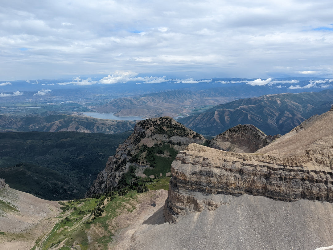
The climb to the saddle is steep, and is sheer in some parts. Watch your footing. The saddle itself is fairly flat, and provides a lot of space, which can be enjoyed by many. It’s a popular spot for a break, and a bite to eat. It functions as the top of a coin, featuring, on one side, views of the meadow, and on the other views of Utah Valley.

From here, the trail gets exciting but a bit difficult! It goes north, and then juts sharply to the east without warning or signage. The distance to the summit is a little over a half mile, and features a solid 700 feet of vertical gain. The air begins to get thin, and the climb can be steep, but not too technical.
At the top you will see the famous shack, where, like the saddle, you will typically see several other hikers taking in the views. Inside the shack, you can sign your name in a book. Many people also write their names on the shack itself.

What’s the summit like? You’ll have to make the ascent and experience it for yourself. I can guarantee one thing: the difficult climb is worth the work.
The feeling at the top is wholly unique.
It’s waiting for you!


Leave a comment